Urbanization
BACKGROUND
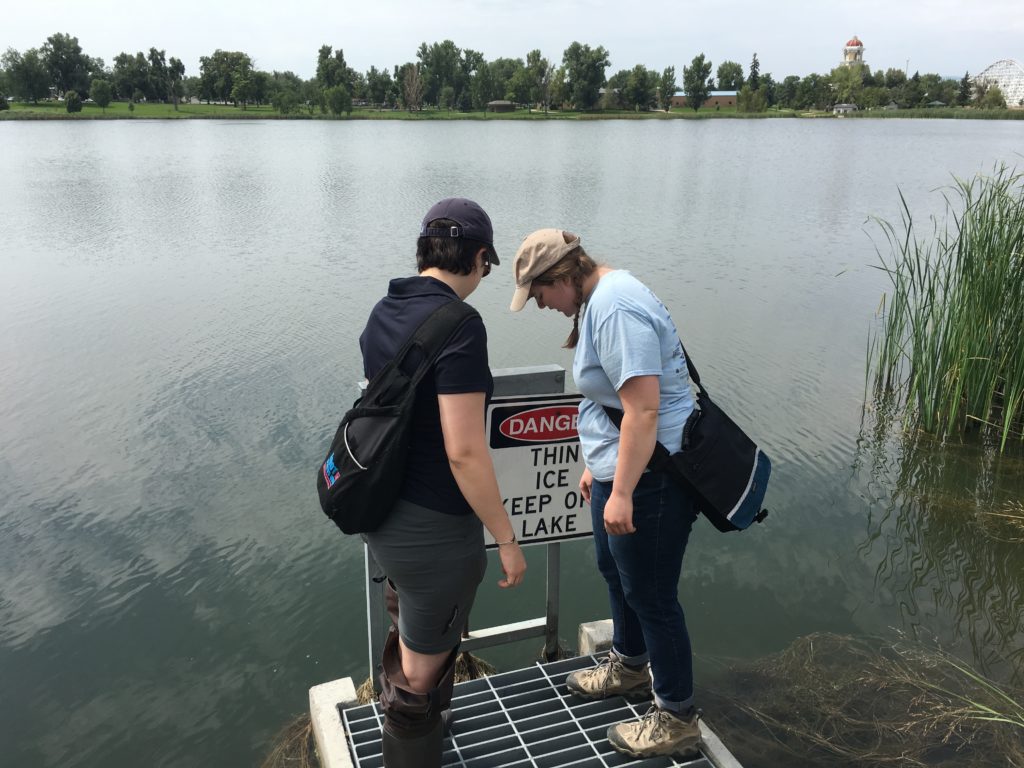
A significant thrust of our research is on urban systems and the coupling between humans and water-energy cycling in semi-arid regions, working to better understand and predict the sustainability of regional water resources. We are also studying urban-fringe watersheds and the impacts of urban pollutants on regional watersheds.
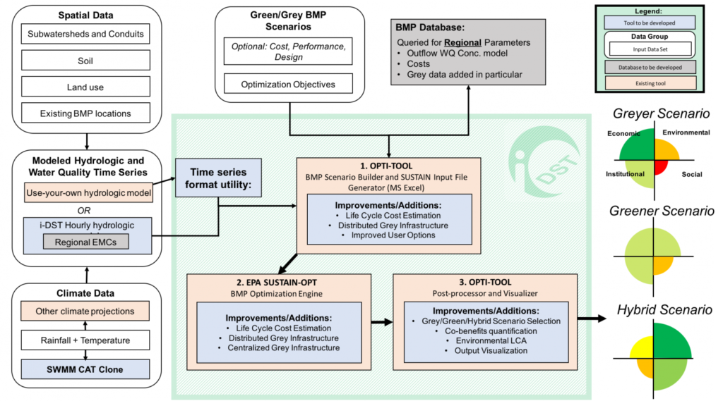
INTEGRATED DECISION SUPPORT TOOL (I-DST) FOR GREY AND GREEN INFRASTRUCTURE
The Hogue research group is developing a tool to assist urban water managers implementing grey and green infrastrucutre. Other members of the project team include other faculty at the School of Mines, UC Berekely, The Nature Conservancy, and the South Dakota School of Mines. The tool will be broadly applicable across sites of varying scales and across all regions of the U.S. The tool will include:
- Hydrologic and water quality models with grey and green infrastructure
- A Life Cycle Cost Assessment (LCCA)
- Valuation of co-benefits of grey and green infrastructure
- Optimization utilities
- Uncertainty assessment
- Climate change predictions
- Novel structural stormwater Best Management Practices (BMPs)
Visit the i-DST project website for more information.
URBAN LAND SURFACE-ATMOSPHERE INTERACTIONS
The Hogue Hydrology Research Group investigates urban land surface-atmosphere interactions, impacts of irrigation on urban meteorological fields, and urban remote sensing.
- Improved understanding and prediction of energy and water cycles, particularly in highly urbanized and semi-arid regions.
- Sophisticated urban irrigation module and generated remote sensing based urban canopy parameters (i.e. albedo, emissivity, and green vegetation fraction)
- Implementated into the Noah LSM-Urban Canopy Model (UCM) modeling framework to improve the capabilities of this modeling system and thereby WRF weather forecasts over municipal areas
Enhanced modeling framework has been applied over broad metropolitan areas under different climate and land use change scenarios to improve current and future water management challenges and decision making processes.
RESIDENTIAL WATER CONSUMPTION PATTERNS
- Residential water consumption patterns and drivers in Los Angeles and the impact of water conservation policies
- Linear regression models with panel data is used to assess the significant predictors in single-family water use, developed over 10 years at the census tract level across the
- Quantified and evaluated residential outdoor water use across LA
- Non-linear mixed effects model implemented between residential water use and vegetation greenness (represented by the NASA MODIS Enhanced Vegetation Index) to estimate landscaping irrigation at the census tract level.