h3 – HUMANITARIAN, HAZARDS, HISTORICAL PRESERVATION
Most of my research over the years has focused on exploration and monitoring for oil, gas, and mining. While I enjoy those projects and fields of application, I take great joy in additionally applying my expertise as an applied geophysicist to issues and applications related to humanitarian needs, hazards, and historical preservation (archaeology). Below are a few of my top adventures.
geoscientists without borders
Dr. Jeffrey Shragge (PI), Dr. Richard Krahenbuhl (Co-PI), Dr. Andrei Swidinsky (Co-PI), Dr. John Bradford (Co-PI), Masters Student Dana Sirota, and Undergraduates Gavin Wilson, Brett Bernstein, and Cullen Young travel to Benin, Africa, as part of Geoscientists Without Borders (GWB). Project purpose:
- Building low-cost geophysical instruments for mapping geology and groundwater.
- Teaching students from the University of Abomey-Calavi (UAC) to build and test their own low-cost geophysical instruments.
- Working together (MINES and UAC) to find water using the low-cost instruments and comparing results to industry-grade tools for quality check


agriculturally induced landslides in peru
Dr. Richard Krahenbuhl (PI), Dr. Yaoguo Li (Co-PI), Dr. Brandon Dugan (Co-PI), Dr. Jeffrey Shragge (Co-PI), PhD Student Hanna Flamme, Masters Student Dana Sirota, and Undergraduates Gavin Wilson, and Michael Field travel to the hyper-arid desert of Majes, Peru, as part of an international collaboration with the National University of Saint Augustine to monitor agriculturally induced landslides. Project purpose:
- Gather a broad collection of geophysical data at Majes I and Majes II with colleagues and students from MINES and UNSA
- Train UNSA colleagues with MINES instruments and interpretation software
- Model local geology and water movement at depth from agricultural irrigation
- Update landslide models for prevention and remediation recommendations


mass graves
Collaborative project between Dr Richard Krahenbuhl at MINES, Michelle Slaughter of Alpine Archaeology, and Lucille Coresentino with Roselawn Cemetery in Pueblo, CO. Project supported by Colorado State Historic Fund. Objectives: Use Ground Penetrating Radar (GPR), DC Resistivity, and Frequency-domain EM to detect mass graves believed to exist in a historic section of the Roselawn Cemetery. The mass graves are associated with the Spanish Influenza pandemic of 1918 and the Great Flood of 1921

unexploded ordnance (uxo)
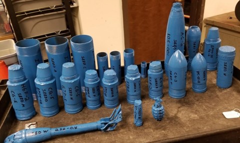
Unexploded ordnance (UXO) are military munitions that were employed, did not detonate, and therefore remain a serious risk. UXO can include bombs, shells, grenades, rockets, etc. and they are the product of both war and military training exercises. In addition to the danger of explosion, buried UXO can additionally cause significant environmental contamination (Wikipedia).
Research funded by the Strategic Environmental Research and Development Program focus largely on extracting the magnetic anomalies from UXO in strongly magnetic environments, and the recovering shape information contained within the higher-order magnetic moments (quadrupole and octupole) for discrimination. In addition to research, I have built a large UXO test grid beneath Kafadar Common as part of the Geophysical Discover Lab.


volcanic monitoring
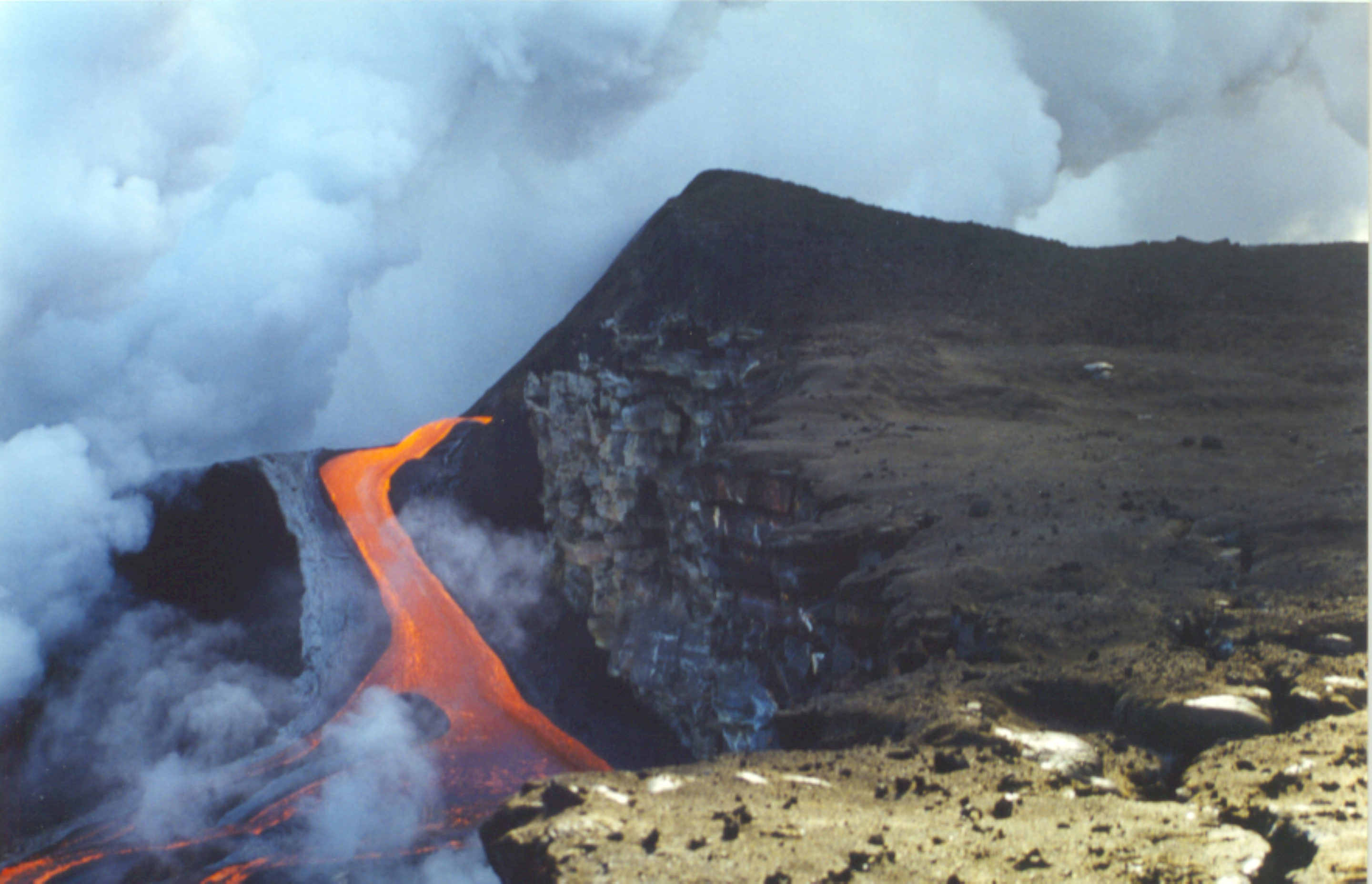
Prior to my arrival at MINES I was a geophysics intern at the Hawaiian Volcano Observatory (HVO), located at the summit of Kilauea Volcano and overlooking the beautiful Kilauea Caldera and Halemaʻumaʻu crater. At the time, I worked with gravity data to model the density distribution within the caldera, and electromagnetic data to detect active lava tubes and calculate the volume flux of lava running through them. Now at MINES, I enjoy occasionally bringing groups of students back to Kilauea to experience the joy of tackling geophysical problems in one of the most exciting settings on Earth. Those projects have included mapping active lava tubes at the lower flow-field, mapping hidden ring fractures around Halema’uma’u crater, time-lapse monitoring of the Halema’uma’u lava lake, and geophysical investigations at the Kahuku archaeology site.


archarology: indian camp ranch
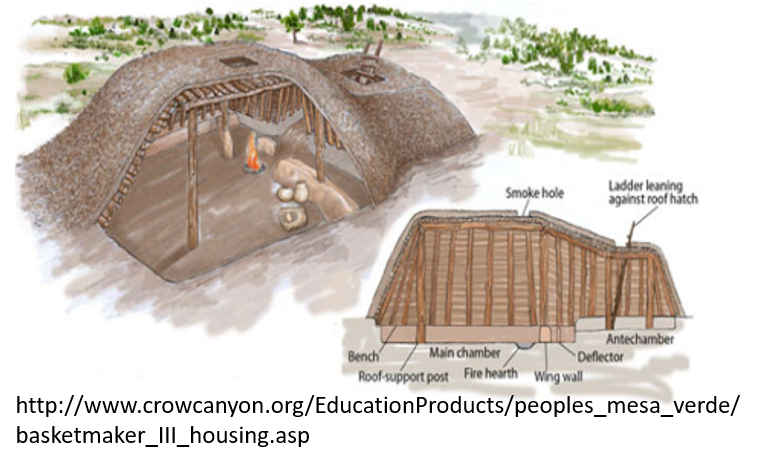
Indian Camp Ranch near the Crow Canyon Archaeological Center in Cortez, Colorado. The targets of interest were a possible pithouse along with storage rooms and a midden from the Basketmaker III cultural period. Geophysical investigations included magnetics, DC resistivity, and electromagnetics. The data revealed the likelihood of a pithouse which was confirmed shortly after by the archaeologists. The geophysical study was tackled at MINES with a group of undergraduate students, and our sponsor at Crow Canyon Archaeological Center was an amazing archaeologist names Shanna Diederichs. Thanks, Shanna, for supporting our students’ education!

