
geophysical discovery lab [gdl]
The most rewarding and impactful project I have undertaken at MINES has been the designing, funding, and construction of a massive, outdoor, underground geophysical laboratory for long-term research and education in the heart of MINES campus (see map and photos of buried targets below).
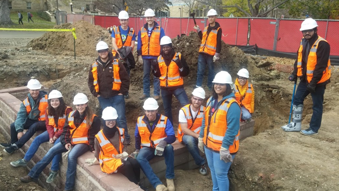
BACKGROUND: This two year undertaking began with the demolition of Meyer Hall on MINES campus and the subsequent construction of the new CoorsTek Center for Applied Science and Engineering in its place. Coincident with the construction, a large grassy field, Kafadar Common, was stripped and established as a staging area in front of the Department of Geophysics and the future CoorsTek building. At the time, I proposed and was granted a one-time window of opportunity, between the completion of CoorsTek and the rebuild of Kafadar Commons, to design, fund, and construct a large, one of a kind underground laboratory complete with distributed sensors, boreholes, and numerous targets of varying physical properties, geometries, depths, and levels of overlap/interference. Throughout the process, I had the pleasure of working with an amazing collection of colleagues within the department, government, and industry for feedback and guidance when necessary. Additionally, I had the privilege of incorporating students and the department’s Laboratory Coordinator into significant aspects of the design and construction process, and they were amazing. I could not have done this without them. For the list of my Partners in Crime and those I must Thank/Acknowledge, please read about them at the bottom of this page. The complete laboratory development, from initial discussion with the university to completion of the final item, took two years to the date.
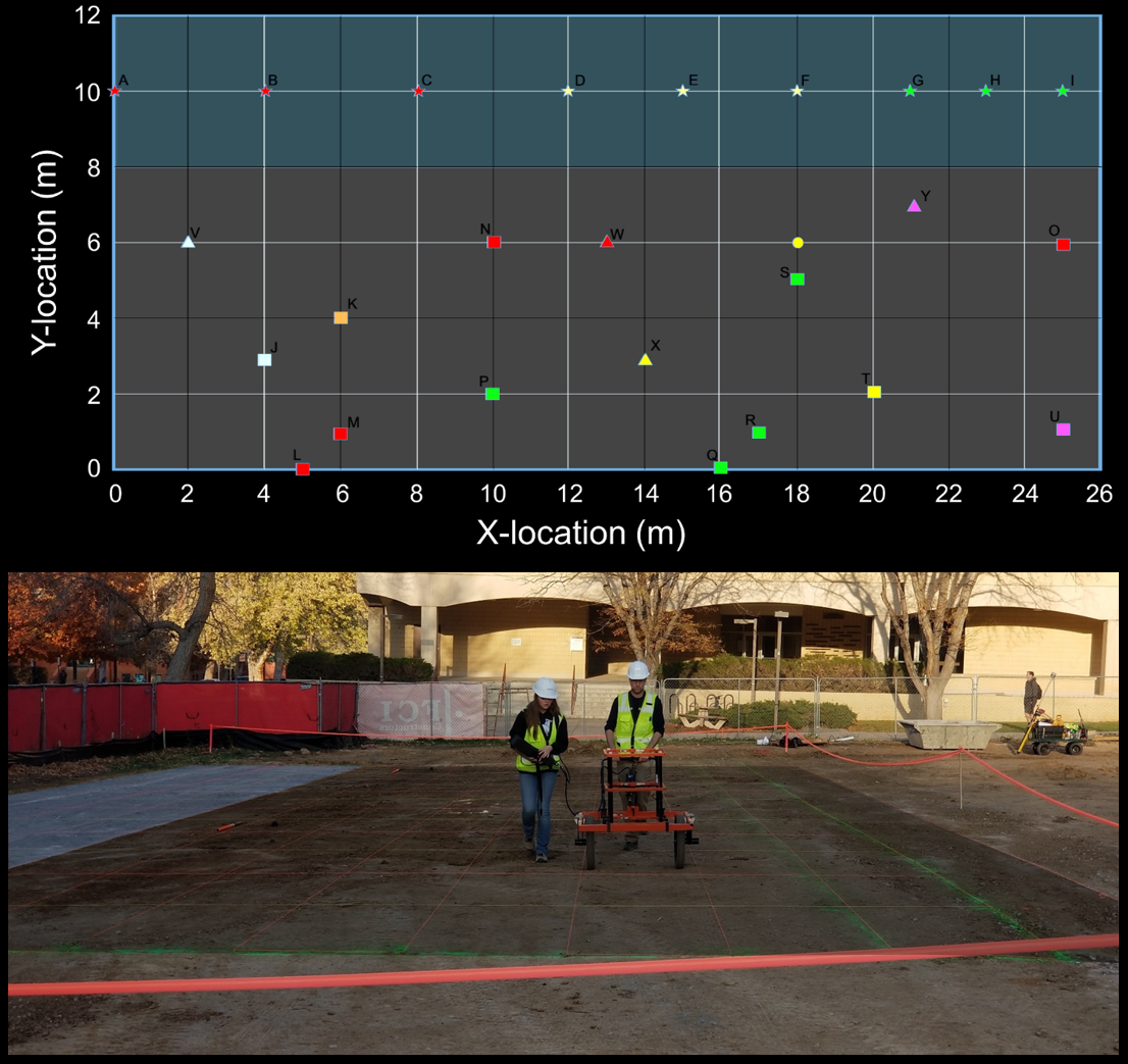
map of mines gdl

CLICK ON IMAGES BELOW FOR FULL PICTURES
UNEXPLODED ORDNANCE GRID
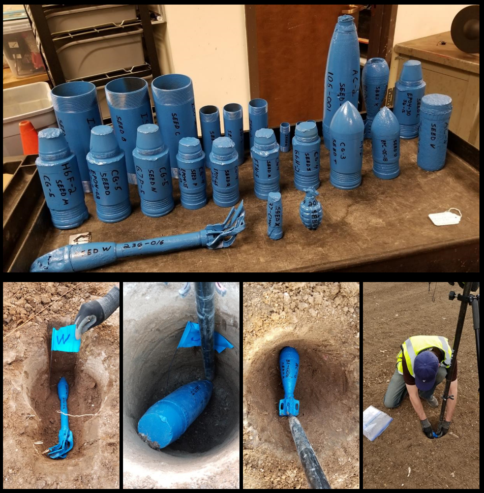
16 UXO & 9 ISO TARGETS
UXO/ISO Grid Map and TEM Survey
The GDL contains a large UXO grid in the north-east section of the field lab. The site contains 25 total targets, including 9 industry standard objects (ISO) and 16 inert unexploded ordnance (UXO) items. The grid, shown in the final design map, is divided into two sections. The first is a 4m wide by 26m long instrument verification strip (IVS) containing the 9 ISOs. To the south of the IVS is an 8m by 26m geophysical prove out (GPO) with the 16 seeded UXOs. The UXOs are comprised of a combination of rockets, mortars, projectiles, and an MK2 hand grenade. The primary geophysical methods deployed at the UXO grid are magnetics and TEM.
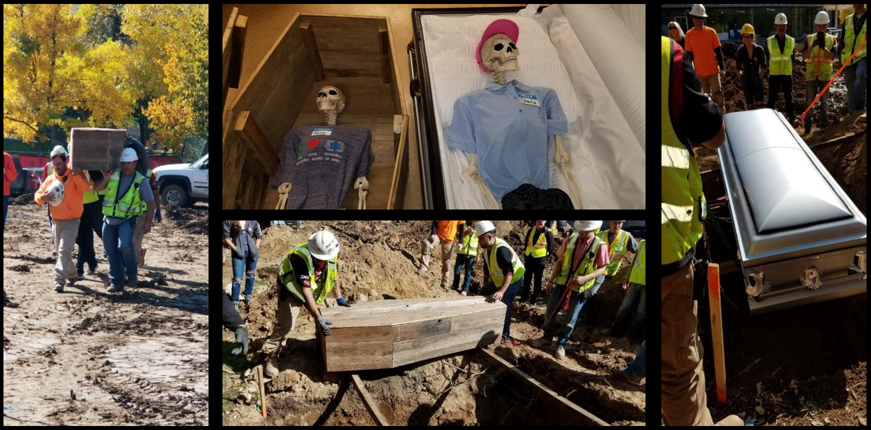
CEMETERY WITH MIXED GENERATION COFFINS
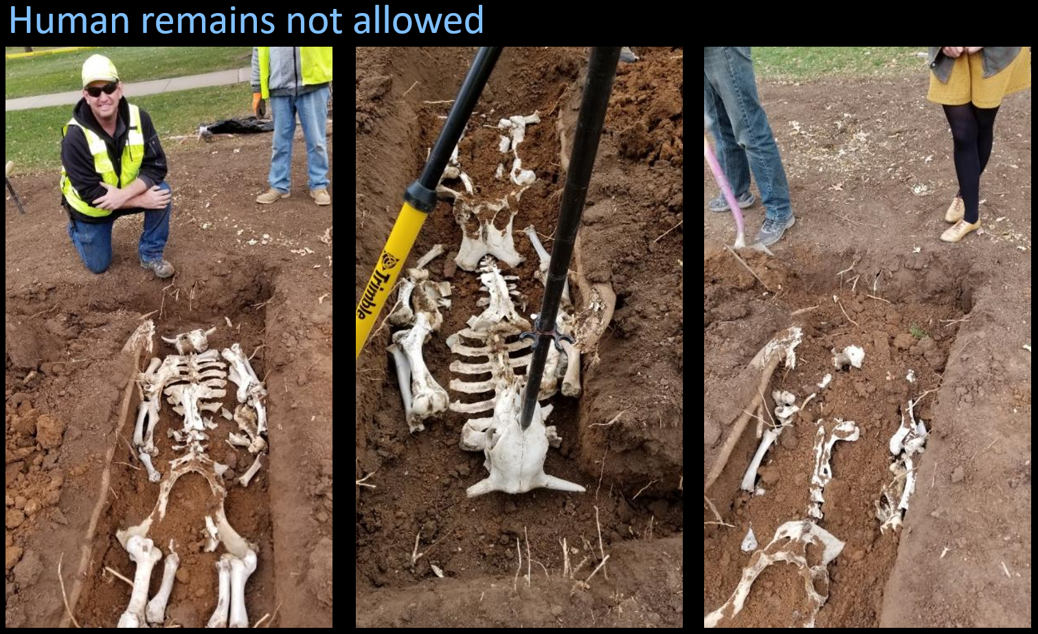
Shallow Grave, Minotaur, Geophysics Surveys
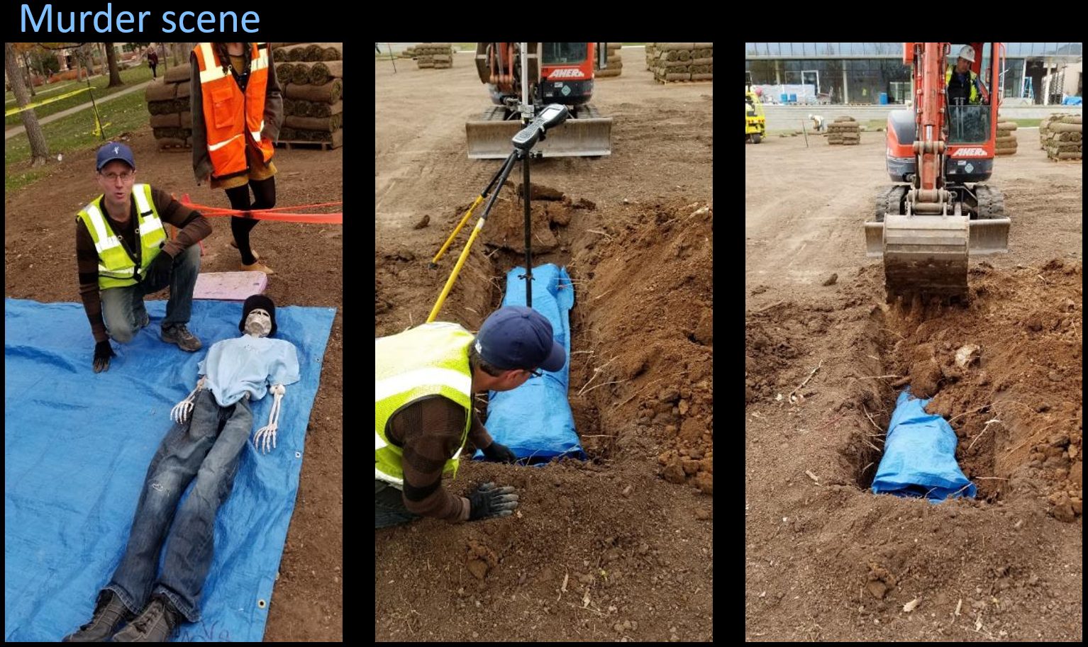
CLANDESTINE GRAVE AT CSM FOR GEOPHYSICS
CEMETERY & CLANDESTINE GRAVES
In the north of the field are four grave sites. One section represents burials in a cemetery with a modern coffin containing metal and plastic, and an old-style toe-pincher coffin constructed from old barn wood. The remaining sites represent two clandestine graves. In the first, a body has been wrapped in a tarp and dragged to a shallow grave; and the second contains bones within a shallow grave. The coffins are buried at 6ft depth and the clandestine graves are at depth of 2ft. With the exception of the modern coffin, the cemetery and clandestine graves provide challenging targets for most of the geophysical methods.
GEOPHYSICS STUDENTS HELPED BUILD THE ARCHAEOLOGY WALLS

SCALE OF ARCHAEOLOGY WALLS FROM ON TOP OF COORS TEK
ARCHAEOLOGY WALLS
To the south-west of the cemetery and clandestine graves is a collection of subsurface walls constructed to represent archaeological structures. The archaeology walls include three connected wall segments constructed from landscape brick with section lengths of 25ft, 15ft, and 10ft. The walls start at a depth of 2ft below surface and extend to a depth of 6ft. Students from my past Geophysical Field Methods class joined in to help build the archaeology walls. The primary geophysical methods deployed at the archaeology walls are seismic, DC resistivity, and frequency-domain electromagnetics.
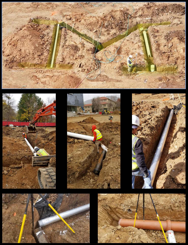
UTILITY PIPES
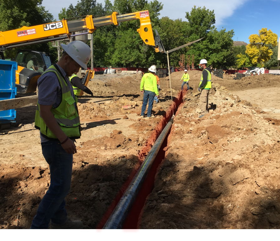
80-FT DIPPING GAS LINE
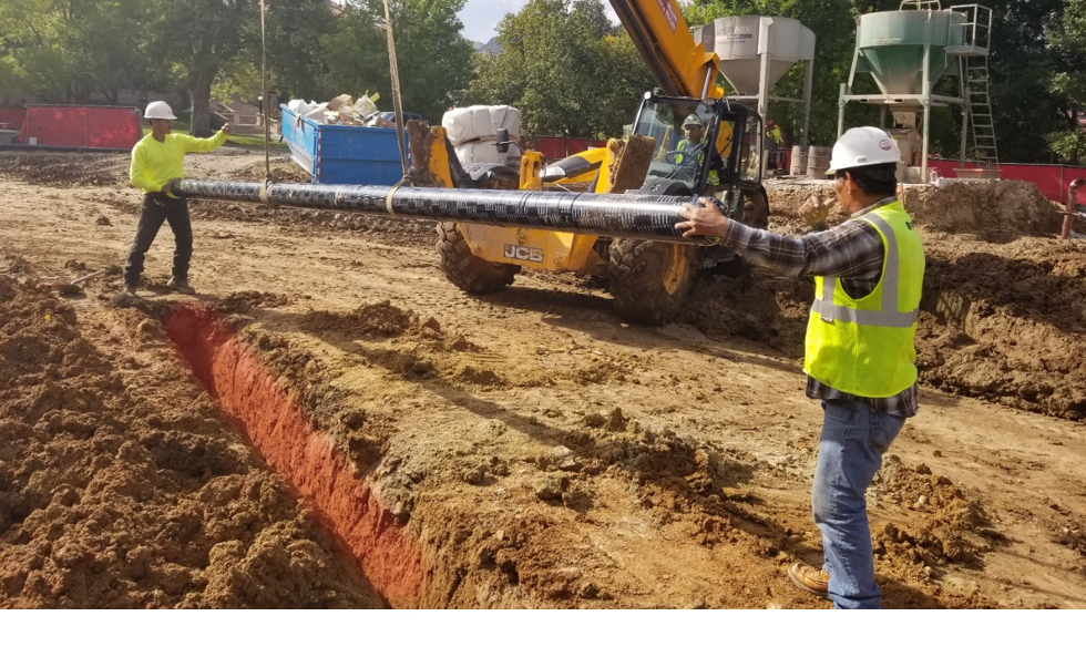
INTERFERING IRON PIPES
Two targets have been placed in the field site with isolated and overlapping/interfering metal pipes. The first is an 80ft iron gas line dipping to the north with a shallow depth of 2ft and a maximum depth of approximately 7ft. The second item is a pair of horizontal iron pipes, one overlying the other, with a depth of 3ft for the shallow pipe and 6ft for the deeper pipe. While both targets provide strong sources for magnetics, electrical, and EM methods, the dipping gas line provides students with insight into the behavior of anomalies for targets at varying depths; additionally, the overlying pipes present students with the difficult challenge of detecting and resolving a strong source target that is overlain by a shallower yet equally strong source body.
DIPPING CEMENT SLAB
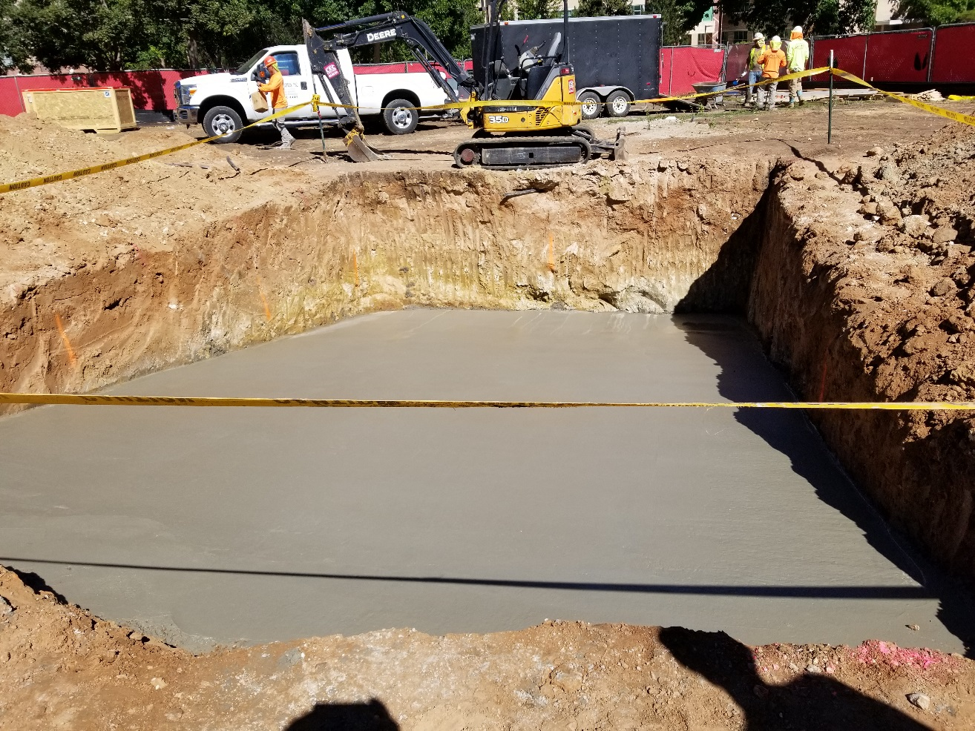
DIPPING CEMENT SLAB
The first item completed during construction of the outdoor laboratory was a large, dipping cement slab at the east end of the field. The slab is 1ft thick with a strike-length of 20ft in the east-west direction, and a 10° dip to the north with a dip-length of 30ft. The top of the slab has a shallow depth of 2ft at the south end of the structure, and extends to a depth of 7.2ft in the north. The cement target is rotated approximately 45° from the sidewalks surrounding the field site. The cement slab was initially conceived as a strong near-surface dipping target for the individual and joint interpretation of seismic and DC resistivity. However, a target with such well-defined boundaries and strong physical property contrasts to the surrounding sediment will be valuable for many geophysical experiments.
LARGE “M” WITH DIFFERENT PHYSICAL PROPERTIES
LARGE “M” WITH EIGHT DIFFERENT PROPERTIES
At the center of the field lab is a large “M”, spanning an area of approximately 25ft by 25ft and buried at a depth of 2ft beneath the surface. The “M” is comprised of eight segments, similar to the MINES “M” on Lookout Mountain, with each segment containing a distinctly different physical property. In total, the “M” is built from clay, cement, aluminum, iron, pvc with salt water, pvc with air, river rock, and hard wood railroad ties. No single geophysical method will detect the entire “M” feature at the discovery lab.
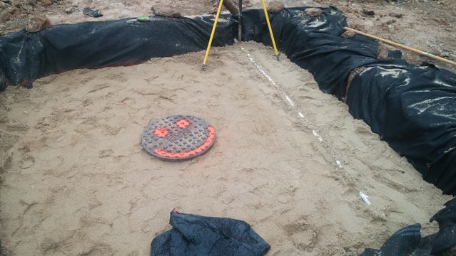
SAND BED WITH MANHOLE COVER
CLEAN SAND BED WITH MANHOLE COVER
One of the more difficult geophysical challenges in the Kafadar Common field, and along the Colorado front range in general, is the use of ground penetrating radar to see targets through the highly conductive surface shale. To overcome this difficulty and provide students with a clear target for GPR experiments, we have buried a manhole cover within a 10ft by 10ft bed of clean sand. The sand bed is two feet thick and begins approximately 6 inches below the surface. The manhole cover is centered within the sand bed in all three directions.
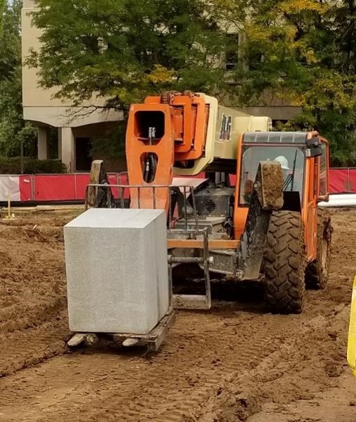
GRANITIC BLOCK
GRANITIC BLOCK
A large block of granite, 2.5ft by 2.5ft by 3ft, was buried at a depth of 3ft in the south-central part of the laboratory. The block, a decades old relic from past petrophysical experiments has been sitting in the basement of the Green Center for over two decades. It now provides a compact, isolated target with strong physical property contrasts relative to the surrounding host sediment for several geophysical methods labs.
DAS / DTS ARRAY WITH PIPING FOR SPECIAL DAS SURPRISE IN THE FUTURE
DAS / DTS ARRAY
Approximately 1km of fiber optic cable has been buried 1m beneath the surface of Kafadar, above and around the previously defined targets, for distributed acoustic and temperature sensing experiments. The cable follows a grid pattern within the field site as shown by the trenching in the photograph. The FO lead begins in the new CoorsTek building and the remaining cable end extends into the westernmost borehole straddling the utility tunnel on the edge of Kafadar Common. In addition to sensing routine foot traffic, ultimate frisbee practices and speeding vehicles, the DAS array has successfully detected earthquakes.
WELL-PAIR LINED WITH ERT AND DAS SENSORS
METAL CASED BOREHOLE IN MIDDLE OF GDL FIELD

OPEN HOLE BOREHOLE WITH CORES PRESERVED
BOREHOLES, WITH AND WITHOUT SENSORS; TUNNEL DETECTION
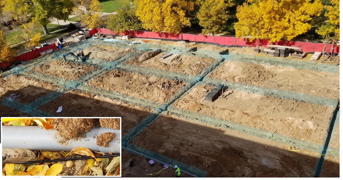
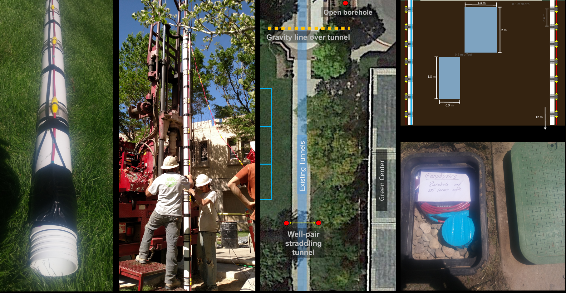
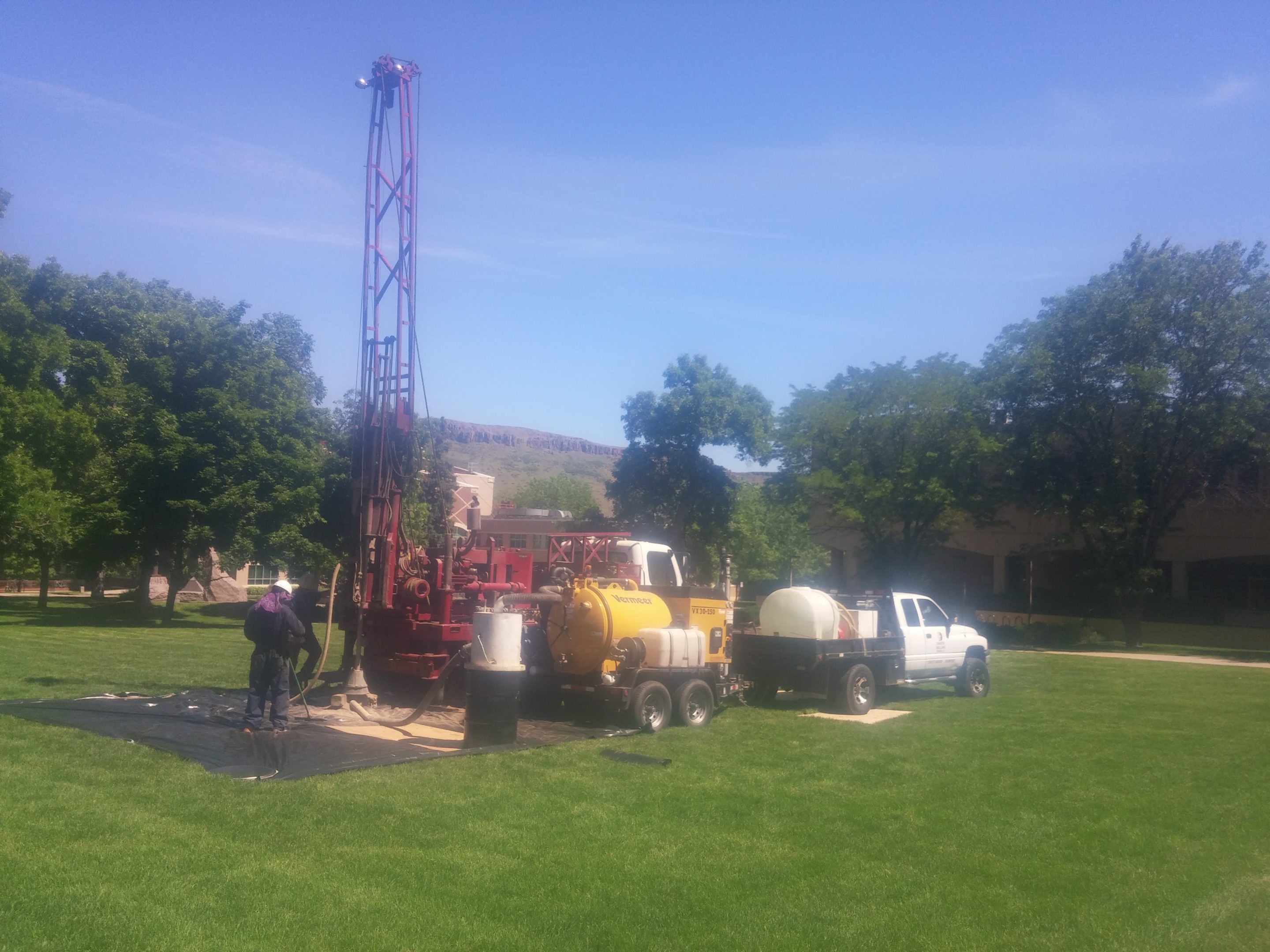
Four boreholes were drilled at the end of the GDL construction. The first borehole contains 6 inch diameter steel casing to a depth of 60ft within Kafadar. The metal casing provides a magnetic and EM target in contrast to the horizontal and dipping pipes described previously, as well as provide a centralized location within the field for a borehole seismic source. The second borehole is a 60ft open hole approximately 25 meters to the north of Kafadar for traditional well logging labs with the cores preserved to tie with the local geology. The remaining two boreholes are a set of PVC cased well-pairs that straddle two shallow utility tunnels at the east end of Kafadar for cross-hole ERT and seismic experiments. The tunnel was previously only detected with microgravity at the surface, and the cross-hole data from these specialized wells will provide additional tools for imaging this near surface target.
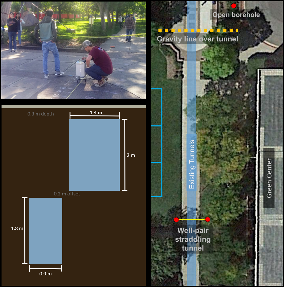
GRAVITY LINE OVER UTILITY TUNNELS
GRAVITY LINE OVER UTILITY TUNNELS
Two underground utility tunnels run parallel to Kafadar Common along the eastern edge of lab. At the northern end of the field, crossing over these tunnels is an established gravity survey line. The tunnels provide a well defined negative gravity anomaly on the order of tens of microgal and the annual tunnel tour prior to surveys is always an exciting adventure for our students.
MAP: GEOPHYSICAL DISCOVERY LAB
SECRET ITEMS
Within the Geophysical Discovery Lab there are seven additional targets buried beneath Kafadar that will remain a secret. They are widely varying in size, geometry, depth, depth extent, physical properties, and difficulty of detection.
partners in crime, and acknowledgements
PARTNERS IN CRIME: This project was tackled with the continuous and essential help of Brian Passerella, Hanna Flamme, Glenna Drookston, and Dana Sirota. They were amazing collaborators who stood by my side and contributed significant time to the design and construction of this fun laboratory project.
ACKNOWLEDGEMENTS: Many institutions, companies, and individuals contributed to the development of this wonderful outdoor laboratory. Their support has been in the form of approvals, funding, target donations and discounts, guidance, modeling, and labor. We gratefully acknowledge: CSM Technology Fee Committee; every student registered at CSM in Fall 2017 for paying into the Technology Fee fund; Department of Geophysics at CSM; Yaoguo Li; Terry Young; Tom Boyd; Michelle Szobody; Gary Olhoeft; John Bradford; Brandon Dugan; Chris Cocallas; Ramona Graves; Mike Bowker; Whitney Trainor-Guitton; Andrei Swidinsky; Chaeli Trost; Adam Mangel; Fall 2017 CSM GP Field Methods Class; Amy Walker [USACE Eng. & Support Center]; Ryan North [USACE-ERDC / NecroSearch]; Seth Hanes [USGS]; Andy Kass [USGS]; Ben Bloss [USGS]; Paul Bedrosian [USGS]; Hunter Knox [SNL]; Tim Johnson [PNNL]; Raymond Spinhirne [my father-in-law who built the toe-pincher coffin]; Wendy Thomas [Pioneer Landscape Center-Golden CO]; and from FCI Constructors: Keith Emrick, Logan Lenz, Dean Cinocco, Tony Seidling, Craig Weitzel, and Rigo Ortega
requesting site access
To request use of the GDL, first verify with the Department of Geophysics that the site does not have a scheduled lab, and then visit Mines Online Events Reservations